Contact address | Imprint | Deutsch

Cartographica Helvetica
Special issues (vol. 1–26)
compiled by
Markus Oehrli
Volume
26 |
25 |
24 |
23 |
22 |
21 |
20 |
19 |
18 |
17 |
16 |
15 |
14 |
13 |
12 |
11 |
10 |
9 |
8 |
7 |
6 |
5 |
4 |
3 |
2 |
1

Special issue 26
Schmid, Jost; Sunderland, Helen (eds): Fantastische Karten zu legendären Geschichten. Murten: Cartographica Helvetica, 2026. (Cartographica Helvetica. Special issue 26). – 56 pages, 48 illustrations, bibliography. – Accompanying booklet to the exhibition in the Zentralbibliothek Zürich.
CHF 23.– (Switzerland), CHF 35.– (Europe and Overseas). Prices include shipping. Please order here.
Note: An English edition is in preparation!
Table of contents:
- Schmid, Jost; Sunderland, Helen: Überblick – Welten erschaffen mit fantastischen Karten. 4–6
- Mittman, Asa S.; Schmid, Jost: Wundersames am Rand einer fantastischen Welt: Mittelalterliche «mappae mundi» und ihre literarischen Ursprünge. 7–18
- Honegger, Thomas: Von «The City» nach Westeros – Landkarten zu fantastischen Welten und ihre Funktionen. 19–25
- Kümmerling, Marie Christin: Merkmale und Funktionen von Tolkiens Karten in «Der Hobbit» und «Der Herr der Ringe». 26–36
- Weigelt, Lisa: Kollaborative Kartografie in «Dungeons & Dragons». 37–44
- Broche des Combes, Eric de: Karten und Geografie in sieben wegweisenden Videogames. 45–55

Special issue 25
Feldmann, Hans-Uli: Die Schichtgravur auf Glas: 50 Jahre Technikgeschichte bei der Landestopografie. Murten: Cartographica Helvetica, 2026. (Cartographica Helvetica. Special issue 25). – 59 pages, 39 illustrations, bibliography.
CHF 20.–
Summary
Special issue 24
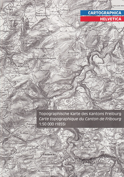
Feldmann, Hans-Uli; Maggetti, Marino: Die Topographische Karte des Kantons Freiburg 1:50 000 = La Carte topographique du Canton de Fribourg 1:50 000. Murten: Cartographica Helvetica, 2021. (Cartographica Helvetica. Special issue 24). – 20 pages, 22 illustrations, 1 table, bibliography. – Commentary to the facsimile edition.
CHF 12.–
Table of contents:
- Feldmann, Hans-Uli; Maggetti, Marino: Die Topographische Karte des Kantons Freiburg 1:50 000. 3–12
 DOI: 10.5169/seals-1036773
 - Feldmann, Hans-Uli; Maggetti, Marino: La Carte topographique du Canton de Fribourg 1:50 000. 12–20
DOI: 10.5169/seals-1036774
Special issue 23
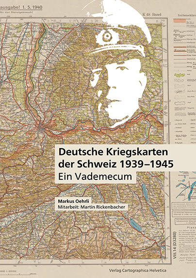
Oehrli, Markus; Rickenbacher, Martin (collab.): Deutsche Kriegskarten der Schweiz 1939–1945: ein Vademecum. Murten: Cartographica Helvetica, 2014. (Cartographica Helvetica. Special issue 23). – 100 pages, 50 illustrations, 3 tables, bibliography, glossary, index.
CHF 48.–
DOI: 10.5169/seals-1036770
Summary |
Update: Camouflage codes of printing businesses
Special issue 22
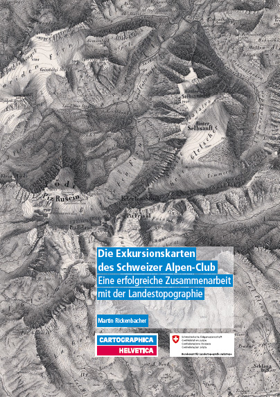
Rickenbacher, Martin: Die Exkursionskarten des Schweizer Alpen-Club: Eine erfolgreiche Zusammenarbeit mit der Landestopographie. Murten: Cartographica Helvetica, 2013. (Cartographica Helvetica. Special issue 22). – 36 pages, 30 illustrations, bibliography. – Commentary to the facsimile edition and accompanying booklet to the exhibitions in the Zentralbibliothek Zürich and the Alpine Museum of Switzerland.
CHF 20.–
DOI: 10.5169/seals-1036772
Special issue 21
Feldmann, Hans-Uli; Wyder, Samuel: Hans Conrad Gyger: seine Schweizerkarten (1620–1657). Murten: Cartographica Helvetica, 2012. (Cartographica Helvetica. Special issue 21). – 20 pages, 20 illustrations, 1 table, bibliography. – Commentary to the facsimile edition.
CHF 12.–
DOI: 10.5169/seals-1036775
Special issue 20
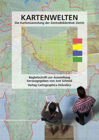
Schmid, Jost (ed.): Kartenwelten: die Kartensammlung der Zentralbibliothek Zürich. Murten: Cartographica Helvetica, 2010. (Cartographica Helvetica. Special issue 20). – 56 pages, 57 illustrations, bibliography. – Accompanying booklet to the exhibition in the Zentralbibliothek Zürich.
CHF 20.–
Table of contents:
- Germann, Thomas: Für Weltenbummler: Stadtpläne und touristische Karten. 4–15
DOI: 10.5169/seals-1036776 - Schmid, Jost; Germann, Thomas: Kartenverwandte Weltsicht: Panoramen, Profile, Globen & Co. 16–27
DOI: 10.5169/seals-1036777 - Schmid, Jost: Fiktive Welten: Phantastische und ideologische Schauplätze. 28–39
DOI: 10.5169/seals-1036778 - Oehrli, Markus: Welt im Wandel: Landschaftsveränderungen und Ortsnamen (mit einem Exkurs über Kartenwerke). 40–54
DOI: 10.5169/seals-1036779
Special issue 19
Oehrli, Markus (ed.): Paper and poster abstracts of the 22nd International Conference on the History of Cartography, Berne 2007 = Zusammenfassungen der Vorträge und Poster der 22. Internationalen Konferenz zur Geschichte der Kartographie, Bern 2007 = Résumés des communications et affiches du 22e Congrès International de l'Histoire de la Cartographie, Berne 2007. Murten: Cartographica Helvetica, 2007. (Cartographica Helvetica. Special issue 19). – 224 pages, 11 illustrations.
CHF 30.–
Full text (3.5 MB).
Special issue 18
Wyder, Samuel: Grenz-, Zehnten- und Befestigungspläne des Zürcher Gebiets von Hans Conrad Gyger (1599–1674). Murten: Cartographica Helvetica, 2006. (Cartographica Helvetica. Special issue 18). – 54 pages, 51 illustrations, bibliography.
CHF 25.–
DOI: 10.5169/seals-1036771
Special issue 17
Höhener, Hans-Peter: Die Gebietseinteilung der Schweiz von der Helvetik bis zur Mediation (1798–1803). Murten: Cartographica Helvetica, 2003. (Cartographica Helvetica. Special issue 17). – 20 pages, 18 illustrations, 2 tables. – Commentary to the facsimile edition.
CHF 12.–
DOI: 10.5169/seals-1036737
Special issue 16
Scharfe, Wolfgang (ed.): 8. Kartographiehistorisches Colloquium Bern 1996. Vorträge und Berichte. Murten: Cartographica Helvetica, 2000. (Cartographica Helvetica. Special issue 16). – X, 225 pages, 111 illustrations, bibliography, index.
CHF 30.–
Table of contents: see 'Tagungsbände' directory (in German)
Special issue 15
Klöti, Thomas; Oehrli, Markus; Feldmann, Hans-Uli (eds.): Der Weltensammler. Eine aktuelle Sicht auf die 16 000 Landkarten des Johann Friedrich von Ryhiner (1732–1803). Murten: Cartographica Helvetica, 1998. (Cartographica Helvetica. Special issue 15). – 60 pages, 64 illustrations. – Accompanying booklet to the exhibition in the Swiss Alpine Museum.
CHF 20.–
Table of contents:
- Barth, Robert: Die Sammlung Ryhiner in der Stadt- und Universitätsbibliothek Bern (StUB). 3
DOI: 10.5169/seals-1036738 - Klöti, Thomas: Zur Ausstellung. 4–5
DOI: 10.5169/seals-1036739 - Herzig, Heinz E.; Hochuli-Gysel, Anne: Der Plan von Avenches von Erasmus Ritter, 1786. 6–10
DOI: 10.5169/seals-1036740 - Willers, Dietrich: Troja und die Troas. 11–13
DOI: 10.5169/seals-1036741 - Cranach, Philipp von: Die Strassenkarten von Pierre Bel. 14–18
DOI: 10.5169/seals-1036742 - Aerni, Klaus: Die Gemmi: von der Verbindung zum Weg. 19–24
DOI: 10.5169/seals-1036743 - Reichen, Quirinus: Karten für Reisende in das Berner Oberland. 25–29
DOI: 10.5169/seals-1036744 - Zumbühl, Heinz J.: Von den «abscheulichen Eisbergen» zu den blauen Gletschern des Atlas Suisse: Gletscher und Karte am Ende des 18. Jahrhunderts. 30–35
DOI: 10.5169/seals-1036745 - Bürgi, Andreas; Cavelti Hammer, Madlena: Franz Ludwig Pfyffers «Höhenflug»: das Relief der Urschweiz (1762–1786). 36–38
DOI: 10.5169/seals-1036746 - Klöti, Thomas: Der Berner Beitrag zur Entdeckung der Nordostpassage: geographische Grillen oder die Hingespinste müssiger und eingebildeter Stubengelehrter? 39–43
DOI: 10.5169/seals-1036747 - Spreafico, Manfred: Der Aralsee: ein Gewässer im Wandel der Zeit. 44–46
DOI: 10.5169/seals-1036748 - Wallner, Thomas: Grenzen und Grenzüberschreitung gestern und heute: der Espace Mittelland, ein neuer Weg. 47–49
DOI: 10.5169/seals-1036749 - Höhener, Hans-Peter: Das Ringen um eine neue Gebietseinteilung in der Helvetik (1798–1803). 50–55
DOI: 10.5169/seals-1036750 - Gunia, Madlon: Restauratorische Betreuung des Ryhiner-Projekts. 56–58
DOI: 10.5169/seals-1036751
Special issue 14
Dürst, Arthur: Die Europa-Karte von Gerard Mercator, 1572. Murten: Cartographica Helvetica, 1998. (Cartographica Helvetica. Special issue 14). – 24 pages, 25 illustrations, bibliography. – Commentary to the facsimile edition.
CHF 12.–
DOI: 10.5169/seals-1036752
Special issue 13
Cavelti Hammer, Madlena; Feldmann, Hans-Uli; Oehrli, Markus (eds.): Farbe, Licht und Schatten. Die Entwicklung der Reliefkartographie seit 1660. Murten: Cartographica Helvetica, 1997. (Cartographica Helvetica. Special issue 13). – 48 pages, 77 illustrations, bibliography. – Accompanying booklet to the exhibition in the Swiss Alpine Museum.
CHF 20.–
Table of contents:
- Cavelti Hammer, Madlena: Die Entwicklung der Reliefkartographie seit 1660. 3–35
DOI: 10.5169/seals-1036753 - Feldmann, Hans-Uli: Die Lithographie in der Reliefkartographie. 36–38
DOI: 10.5169/seals-1036754 - Kretschmer, Ingrid: Frühe wissenschaftliche Alpenpanoramen. 39–41
DOI: 10.5169/seals-1036755 - Rickenbacher, Martin: Reliefdarstellungen im digitalen Zeitalter. 42–43
DOI: 10.5169/seals-1036756
Special issue 12
Dürst, Arthur: Die «Chorographia et topographia» von 1566 des Sebastian Schmid (1533–1586). Murten: Cartographica Helvetica, 1996. (Cartographica Helvetica. Special issue 12). – 20 pages, 36 illustrations, bibliography. – Commentary to the facsimile edition.
CHF 20.–
DOI: 10.5169/seals-1036767
Special issue 11
Giudicetti, Franchino: Eine Ergänzung der Bibliographie der Gesamtkarten der Schweiz von Mercator bis 1802. Murten: Cartographica Helvetica, 1996. (Cartographica Helvetica. Special issue 11). – 64 pages, 31 illustrations, bibliography, index.
CHF 25.–
DOI: 10.5169/seals-1036757
Special issue 10
Wallner, Thomas; Feldmann, Hans-Uli: Die Topographische Karte des Kantons Solothurn von Urs Josef Walker, 1832. Murten: Cartographica Helvetica, 1995. (Cartographica Helvetica. Special issue 10). – 12 pages, 18 illustrations, bibliography. – Commentary to the facsimile edition.
CHF 8.–
DOI: 10.5169/seals-1036764
Special issue 9
Pelletier, Monique: Die herzförmigen Weltkarten von Oronce Fine = Le monde dans un cœur, les deux mappemondes d'Oronce Fine. Murten: Cartographica Helvetica, 1995. (Cartographica Helvetica. Special issue 9). – 16 pages, 11 illustrations, bibliography. – Commentary to the facsimile edition.
CHF 8.–
Table of contents:
- Pelletier, Monique: Die herzförmigen Weltkarten von Oronce Fine. 1–8
DOI: 10.5169/seals-1036768 - Pelletier, Monique: Le monde dans un cœur, les deux mappemondes d'Oronce Fine. 9–16
DOI: 10.5169/seals-1036769
Special issue 8
Rickenbacher, Martin: Das Alpenpanorama von Micheli du Crest – Frucht eines Versuches zur Vermessung der Schweiz im Jahre 1754. Murten: Cartographica Helvetica, 1995. (Cartographica Helvetica. Special issue 8). – 24 pages, 17 illustrations, bibliography. – Commentary to the facsimile edition.
CHF 8.–
DOI: 10.5169/seals-1036758
Special issue 7
Dubas, Jean; Feldmann, Hans-Uli: Typvs Agri Fribvrgensis: Die erste Karte des Kantons Freiburg von Wilhelm Techtermann 1578 = La première carte du canton de Fribourg de Guillaume Techtermann 1578. Murten: Cartographica Helvetica, 1994. (Cartographica Helvetica. Special issue 7). – 20 pages, 20 illustrations, bibliography. – Commentary to the reproduction.
CHF 8.–
Table of contents:
- Dubas, Jean; Feldmann, Hans-Uli: Typvs Agri Fribvrgensis: Die erste Karte des Kantons Freiburg von Wilhelm Techtermann 1578. 1–10
DOI: 10.5169/seals-1036735 - Dubas, Jean; Feldmann, Hans-Uli: La première carte du canton de Fribourg de Guillaume Techtermann 1578. 12–19
DOI: 10.5169/seals-1036736
Special issue 6
Dürst, Arthur; Feldmann, Hans-Uli; Höhener, Hans-Peter; Oehrli, Markus (eds.): Die Ostschweiz im Bild der frühen Kartenmacher. Murten: Cartographica Helvetica, 1994. (Cartographica Helvetica. Special issue 6). – 56 pages, 91 illustrations, bibliography, index. – Accompanying booklet to the exhibition in the Swiss National Museum.
CHF 20.–
Table of contents:
- Höhener, Hans-Peter: Ein Überblick zur Geschichte der Kartographie der Schweiz bis 1850. 3–52
DOI: 10.5169/seals-1036762
Special issue 5
Giudicetti, Franchino: Die italienischen Nachzeichnungen der Schweizer Karte des Aegidius Tschudi, 1555–1598. Murten: Cartographica Helvetica, 1993. (Cartographica Helvetica. Special issue [5]). – 15 pages, 8 illustrations, bibliography.
CHF 8.–
DOI: 10.5169/seals-1036766
Special issue 4
Castellani Zahir, Elisabeth; Voogt, Johan W.F.; Ingen-Housz, Johannes M.L.; Feldmann, Hans-Uli: Henripolis: Karten zu einem Stadtgründungsprojekt des 17. Jahrhunderts. Murten: Cartographica Helvetica, 1993. (Cartographica Helvetica. Special issue [4]). – 9 pages, 8 illustrations, bibliography. – Commentary to the facsimile edition.
CHF 8.–
DOI: 10.5169/seals-1036763
Special issue 3
Dürst, Arthur: Andreas Hefti, Topograph und Kartograph 1862–1931. Murten: Cartographica Helvetica, 1993. (Cartographica Helvetica. Special issue [3]). – 14 pages, 13 illustrations. – Commentary to the facsimile edition.
CHF 8.–
Table of contents:
- Dürst, Arthur: Andreas Hefti, Topograph und Kartograph 1862–1931. 1–12
DOI: 10.5169/seals-1036759 - Zweifel, Ruedi: Kulturgeographische Aspekte zur Kriegsspiel-Karte Baden. 13–14
DOI: 10.5169/seals-1036760
Special issue 2
Oberli, Alfred: Trigonometrisch-Topographische Karte des Kantons Aargau 1:25 000 1837–1843. Murten: Cartographica Helvetica, 1991. (Cartographica Helvetica. Special issue [2]). – 16 pages, 22 illustrations, bibliography. – Commentary to the facsimile edition.
CHF 8.–
DOI: 10.5169/seals-1036761
Special issue 1
Oberli, Alfred: Die Michaelis-Karte des Kantons Aargau 1:50 000 1837–1849. Murten: Cartographica Helvetica, 1991. (Cartographica Helvetica. Special issue [1]). – 16 pages, 18 illustrations, bibliography. – Commentary to the facsimile edition.
CHF 8.–
DOI: 10.5169/seals-1036765
© 1990–2026 Cartographica Helvetica (Imprint)

