Contact address | Imprint | Deutsch
Cartographica Helvetica
Facsimiles
compiled by
Markus Oehrli
Region and year
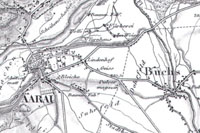
Aargau 1849 |
Aargau 1843 |
Aigle 1788 |
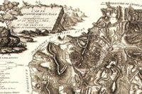
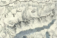
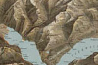
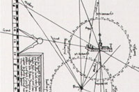
Alps 1755 |
Avenches 1786 |
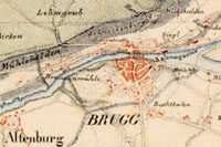
Baden 1897 |
Basel 1839 |
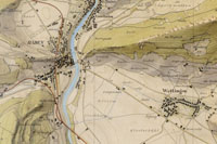
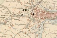
Bern 1856 |
Bernese Oberland 1796 |
Central Switzerland 1887 |
Europe 1572 |
Fribourg 1855 |
Fribourg 1847 |
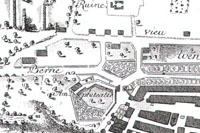
Fribourg 1578 |
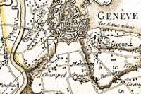
Geneva 1776 |
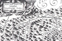
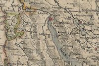
Grisons 1620 |
Henripolis 1626 |
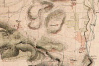
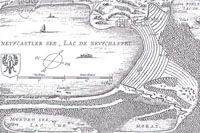
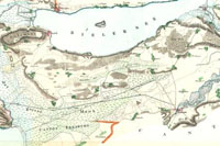
Jura lakes 1817 |
Lyss – La Reuchenette 1848 |
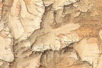
Matterhorn 1892 |
Mont Blanc 1896 |
Neunkirch 1879 |
Sanetsch 1846 |
Schaffhausen 1684 |
Solothurn 1832 |
Solothurn 1822 |
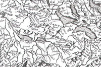
Surveys 1566 |
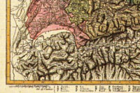
Switzerland 1844 |
Switzerland 1825 |
Switzerland 1803 |
Switzerland 1657 |
Switzerland 1643 |
Valais 1865 |
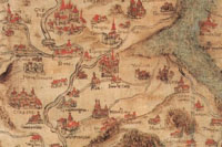
Valais 1545 |
World 1536 |
Zug 1780
Technical remarks
Aargau 1849
- Title / author
- Topographische Karte des eidgenössischen Kantons Aargau: im Auftrage der Staatsbehörden nach dem Massstabe von 1:25,000 in den Jahren 1837 bis 1843 aufgenommen und 1844/45 in den Massstab von 1:50,000 übertragen / durch Ernst Heinrich Michaelis
- Edition
- Facsimile of the 1849 edition
- Math. data
- 1:50,000 (E 7°42'–E 8°29'/N 47°39'–N 47°07')
- Imprint
- Murten: Cartographica Helvetica, 1991
- Size
- 1 map in 4 sheets: black/white; each 65 x 56 cm + commentary (16 pp. = Cartographica Helvetica. Special issue [1])
- Price
- Set price CHF 110.–
Aargau 1843
- Title / author
- Trigonometrisch-topographische Karte des eidgenössischen Kantons Aargau: im Auftrag der Staatsbehörden nach dem Massstabe von 1:25,000 in den Jahren 1837 bis 1843 aufgenommen / durch Ernst Heinrich Michaelis
- Edition
- Facsimile of the 1837/43 manuscript maps
- Math. data
- 1:25,000 (E 7°42'–E 8°29'/N 47°39'–N 47°07')
- Imprint
- Murten: Cartographica Helvetica, 1991
- Size
- 1 map in 18 sheets: colours; each ca. 40 x 48 cm + commentary (16 pp. = Cartographica Helvetica. Special issue [2])
- Price
- CHF 40.– each, set price CHF 440.–
Aigle 1788
- Title / author
- Carte du gouvernement d'Aigle: avec des explications pétrographiques / levée topographiquement par [Isaac Gamaliel] de Rovéréa, père; réduit par J. Sam. Grouner; gravée par Joseph Clausner
- Edition
- Facsimile of the 1788 edition
- Math. data
- [Ca. 1:60,000] (E 6°55'–E 7°12'/N 46°26'–N 46°11')
- Imprint
- Murten: Cartographica Helvetica, 1993
- Size
- 1 map: black/white; 43 x 38 cm
- Price
- CHF 40.–
Alps 1755
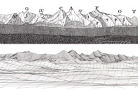
- Title / author
- Prospect géométrique des montagnes neigées, dittes Gletscher, telles qu'on les découvre en tems favorable, depuis le Château d’Arbourg, dans les territoires des Grisons, du Canton d’Ury, et de l'Oberland du Canton Berne / [par Jacques-Barthélemy Micheli du Crest]
- Edition
- Facsimile of the 1755 edition with 1995 reconstruction
- Imprint
- Murten: Cartographica Helvetica, 1995
- Size
- 2 panoramas on 1 sheet: black/white; 65 x 19 and 65 x 11 cm + commentary (24 pp. = Cartographica Helvetica. Special issue 8)
- Price
- CHF 55.–
Avenches 1786
- Title / author
- Plan de la ville d'Avenghe en Suisse et de l'enceinte d'Aventicum Helvetorum / d'après le plan levé en 1769 par Dav. Fornerod; dessiné et augmenté par Mr. Ritter en 1786; M.G. Eichler sculp.
- Edition
- Facsimile of the 1786 edition
- Math. data
- [Ca. 1:6,000] (E 7°02'–E 7°04'/N 46°54'–N 46°52')
- Imprint
- Murten: Cartographica Helvetica, 1993
- Size
- 1 map: black/white; 39 x 35 cm
- Price
- CHF 40.–
Baden 1897
- Title / author
- [War game map of Baden] / [by Andreas Hefti]
- Edition
- Facsimile of the 1897 manuscript map
- Math. data
- 1:10,000 (E 8°17'–E 8°27'/N 47°29'–N 47°26')
- Imprint
- Murten: Cartographica Helvetica, 1993
- Size
- 1 map in 3 parts: colours, mounted; 118 x 60 cm + commentary (14 pp. = Cartographica Helvetica. Special issue [3])
- Note
- Also available as single sheets: Baden, Würenlos, Buchs (ZH)
- Price
- CHF 150.– (single sheets CHF 60.– each)
Basel 1839
- Title / author
- Kanton Basel-Landschaft / verfertigt von F. Baader
- Edition
- Reproduction of the 1839 manuscript map
- Math. data
- 1:25,000 (E 7°30'–E 7°49'/N 47°36'–N 47°26')
- Imprint
- Murten: Cartographica Helvetica, 2000
- Size
- 1 map: colours; 100 x 65 cm
- Price
- CHF 55.–
Bern 1856
- Title / author
- [Bern] / [by Johann Heinrich Denzler]
- Edition
- Facsimile of the 1856 manuscript map
- Math. data
- 1:25,000 (E 7°14'–E 7°29'/N 47°01'–N 46°53')
- Imprint
- Murten: Cartographica Helvetica, 1996
- Size
- 1 map: colours; 70 x 48 cm + commentary
- Series
- (Originalzeichnung für die Topographische Karte der Schweiz 1:25 000, sheet XII, subdivision 3)
- Price
- CHF 55.–
Bernese Oberland 1796
- Title / author
- Carte d'une partie très interessante de la Suisse à l'usage des voyageurs: elle renferme principalement une partie du Canton de Berne et du Valais et les glaciers qui dominent les frontières d'Italie / levée et dessinée trigonométriquement et géométriquement par J.H. Weiss [et J.E. Müller], aux dépens de J.R. M. à Arau, 1796
- Edition
- Facsimile of the 1796 edition
- Math. data
- [Ca. 1:120,000] (E 7°28'–E 8°24'/N 46°58'–N 46°10')
- Imprint
- Murten: Cartographica Helvetica, 1997
- Size
- 1 map: colours; 47 x 66 cm + commentary (8 pp. = Separate print 16/97 23–30)
- Price
- CHF 55.–
Central Switzerland 1887
- Title / author
- Reliefkarte der Centralschweiz / construirt und gezeichnet von X. Imfeld; hrsg. vom Verein zur Förderung des Fremdenverkehrs am Vierwaldstättersee und Umgebung
- Edition
- Facsimile of the 1897 edition
- Math. data
- [Ca. 1:100,000] (E 7°52'–E 9°02'/N 47°12'–N 46°26')
- Imprint
- Horw: Edition Plepp, 2006
- Size
- 1 map: colours; 74 x 61 cm
- Price
- CHF 60.– (distribution only)
Europe 1572
- Title / author
- Europae descriptio emendata anno M.D.LXXII: reverendiss. et illustriss. domino D. Antonio Perrenot ... / Gerardus Mercator Rupelmondanus dedicabat
- Edition
- Facsimile of the 1572 edition
- Math. data
- [Ca. 1:4,300,000] (W 50°00'–E 60°00'/N 73°00'–N 28°00')
- Imprint
- Murten: Cartographica Helvetica, 1998
- Size
- 1 map in 15 sheets: black/white; ca. 165 x 134 cm, on sheets 38 x 50 cm + commentary (24 pp. = Cartographica Helvetica. Special issue 14)
- Price
- Set price CHF 250.–
Fribourg 1855
- Title / author
- Carte topographique du Canton de Fribourg / levée de 1843 á 1851 par Alexandre Stryieński; gravée à Paris, par Th. Delsol; ecrit par J.M. Hacq et Carré
- Edition
- Facsimile of the 1855 edition
- Math. data
- 1:50 000 (E 6°46'-E 7°23'/N 46°59'-N 46°23')
- Imprint
- Murten: Cartographica Helvetica, 2021
- Size
- 1 map in 4 sheets: black/white; 66 x 50 cm each, on sheets 58 x 74 cm + commentary (20 pp. = Cartographica Helvetica. Special issue 24)
- Price
- Set price CHF 90.–
Fribourg 1847

- Title / author
- Environs de Fribourg / J.C. Werdmüller sc.
- Edition
- New printing from the 1847 copper plate
- Math. data
- 1:25,000 (E 7°07'–E 7°12'/N 46°50'–N 46°47')
- Imprint
- Murten: Cartographica Helvetica, 1995
- Size
- 1 map: black/white; 21 x 16 cm + commentary (4 pp.)
- Price
- CHF 90.–
Fribourg 1578
- Title / author
- [Typus agri Friburgensis] / [by Wilhelm Techtermann]
- Edition
- Reproduction of the 1578 manuscript map
- Math. data
- [Ca. 1:100,000] (E 6°35'–E 7°19'/N 47°03'–N 46°27')
- Imprint
- Murten: Cartographica Helvetica, 1994
- Size
- 1 map: colours; 57 x 53 cm + commentary (20 pp. = Cartographica Helvetica. Special issue 7)
- Price
- CHF 55.–
Geneva 1776
- Title / author
- Carte des environs de Genève: comprenant le territoire de cette république et les frontières de France, de Savoye, et de Suisse, entre lesquelles elle est située / dressé par H.M. C.D.G. [i.e. Henri Mallet, citoyen de Genève]; gravé par Guill. de la Haye
- Edition
- Reproduction of the 1776 edition
- Math. data
- [Ca. 1:48,000] (E 5°53'–E 6°20'/N 46°23'–N 46°05')
- Imprint
- Murten: Cartographica Helvetica, 1993
- Size
- 1 map: colours; 69 x 47 cm
- Price
- CHF 55.–
Grisons 1620
- Title / author
- Alpinae seu foederatae Rhaetiae subditarumque ei terrarum nova descriptio = Karte vande Grisons ende Veltolina / auctoribus Fortunato Sprechero à Berneck ac Phil. Cluverio; Nicolaus Geilkerkius sculpsit; Jan Hattu exc.
- Edition
- Facsimile of the ca. 1620 edition
- Math. data
- [Ca. 1:330,000] (E 8°32'–E 10°36'/N 47°00'–N 46°04')
- Imprint
- Murten: Cartographica Helvetica, 1992
- Size
- 1 map: black/white; 51 x 39 cm + commentary (4 pp. = Separate print 5/92 17–20)
- Price
- CHF 55.–
Henripolis 1626
- Title / author
- Représentation du plan et assiette de la novelle ville nommée Henripolis qui se bastit proche de Neufchastel en Suisse / [par Pieter van den Keere?]
- Edition
- Facsimile of the 1626 edition
- Math. data
- Not to scale (E 6°55'–E 7°09'/N 47°05'–N 46°54')
- Imprint
- Murten: Cartographica Helvetica, 1993
- Size
- 1 map: black/white; 41 x 32 cm + commentary (9 pp. = Cartographica Helvetica. Special issue [4])
- Price
- CHF 55.–
Jura lakes 1817
- Title / author
- General Charte der Jura Gewässer = Plan général des eaux de Jura et des inondations qu’elles produisent pendant les grandes cruës / trigonometrisch & geometrisch aufgenommen im Spätjahr 1816 & Frühjahr 1817 unter Direction von Fr. Trechsel; auf 1:50 000 der wahren Grösse reduzirt & gezeichnet durch J. Oppikofer; [Johannes] Lelewel
- Edition
- Facsimile of the 1816/17 manuscript map
- Math. data
- 1:50,000 (E 7°00'–E 7°50'/N 47°17'–N 46°55')
- Imprint
- Murten: Cartographica Helvetica, 2004
- Size
- 1 map: colours; 135 x 33 cm + commentary (4 pp.)
- Price
- CHF 55.–
Lyss – La Reuchenette 1848
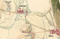
- Title / author
- Carte pour servir à l'intelligence du projet de la route entre Lyss et la Reuchenette relatif à la grande communication de Berne à Bâle / dressée et expédiée par Ber, ingénieur
- Edition
- Facsimile of the 1848 manuscript map
- Math. data
- 1:25,000 (E 7°12'–E 7°20'/N 47°12'–N 47°03')
- Imprint
- Köniz, Horw: Edition Plepp, 1995
- Size
- 1 map: colours; 61 x 32 cm + commentary (1 sheet)
- Price
- CHF 25.– (distribution only)
Matterhorn 1892
- Title / author
- Evolena – Zermatt – Monte Rosa / [Xaver Imfeld]; gestochen von R. Leuzinger
- Edition
- Facsimile of the 1892 edition
- Math. data
- 1:50,000 (E 7°27'–E 7°56'/N 46°54'–N 46°08')
- Imprint
- Bern: Kümmerly und Frey, 1987
- Size
- 1 map: colours; 70 x 48 cm
- Price
- CHF 55.– (distribution only)
Mont Blanc 1896
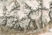
- Title / author
- La chaîne du Mont-Blanc: carte au 1:50 000e / dressée sur l'ordre de Albert Barbey ... par X. Imfeld, d'après les relevés, les mensurations et la nomenclature de Louis Kurz; gravé et imp. par Kümmerly frères, rochers par R. Leuzinger
- Edition
- Facsimile of the 1896 edition
- Math. data
- 1:50,000 (E 6°42'–E 7°08'/N 46°17'–N 45°42')
- Imprint
- Bern: Kümmerly und Frey, 1986
- Size
- 1 map: colours; 96 x 50 cm
- Price
- CHF 55.– (distribution only)
Neunkirch 1879
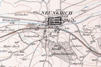
- Title / author
- Neunkirch / Aufnahme von C. Auer; gest. v. H. Müllhaupt u. Sohn
- Edition
- Facsimile of the 1879 edition
- Math. data
- 1:25,000 (E 8°24'–E 8°32'/N 47°42'–N 47°39')
- Imprint
- Murten: Cartographica Helvetica, 1992
- Size
- 1 map: colours; 35 x 24 cm + commentary (14 pp. = Separate print 4/91 3–16)
- Series
- (Topographischer Atlas der Schweiz, sheet 15)
- Price
- CHF 40.–
Sanetsch 1846
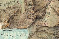
- Title / author
- Carte pour servir à l'intelligence du rapport relatif à la direction à donner à la route de Sanetsch présenté au Département des travaux publics de la République de Berne en date du 10 Juin 1846 / [par Johannes Lelewel]
- Edition
- Facsimile of the 1846 manuscript map
- Math. data
- [Ca. 1:68 000] (E 7°10'–E 7°24'/N 46°34'–N 46°12')
- Imprint
- Köniz, Horw: Edition Plepp, 1995
- Size
- 1 map: colours; 31 x 62 cm + commentary (1 sheet)
- Price
- CHF 25.– (distribution only)
Schaffhausen 1684

- Title / author
- Der Statt Schaffhausen Landschafft und Gebiet: samt dero Grentzen und Marcken, auch umligenden benachbarten Orten / in Grund gelegt von Heinrich Peyern Haubtmann
- Edition
- Reproduction (reduced to about 50%) of the 1684 manuscript map
- Math. data
- [Ca. 1:25,000] (E 8°22'–E 8°52'/N 47°49'–N 47°37')
- Imprint
- Murten: Cartographica Helvetica, 2000
- Size
- 1 map: colours; 80 x 68 cm + commentary (10 pp. = Separate print 22/00 21–30)
- Price
- CHF 60.–
Solothurn 1832
- Title / author
- Carte des Cantons Solothurn: aufgenommen vom Jahr 1828 bis 1832 / Jos. Walker
- Edition
- Facsimile of the 1832 edition
- Math. data
- 1:60,000 (E 7°18'–E 8°04'/N 47°29'–N 47°05')
- Imprint
- Murten: Cartographica Helvetica, 1995
- Size
- 1 map: black/white; 92 x 77 cm + commentary (12 pp. = Cartographica Helvetica. Special issue 10)
- Price
- CHF 60.–
Solothurn 1822
- Title / author
- Plan der Stadt und des Stadtbezirks Solothurn: mit Bewilligung der Hohen Regierung von Solothurn aus den in ihren Archiven liegenden geometrischen Grundrissen (so seit 1819 aufgenommen worden) ausgezogen, reduciert und gezeichnet / durch J.B. Altermatt; G. Thoma sculp.
- Edition
- Facsimile of the 1822 edition
- Math. data
- [Ca. 1:10,000] (E 7°29'–E 7°34'/N 47°14'–N 47°10')
- Imprint
- Murten: Cartographica Helvetica, 1996
- Size
- 1 map: black/white; 48 x 51 cm
- Price
- CHF 45.–
Surveys 1566
- Title / author
- Chorographia et topographia / Sebastian Schmid
- Edition
- Facsimile of the 1566 manuscript volume
- Imprint
- Murten: Cartographica Helvetica, 1996
- Size
- 1 booklet (24 pp.): black/white + commentary (20 pp. = Cartographica Helvetica. Special issue 12)
- Price
- CHF 55.–
Switzerland 1844
- Title / author
- Erste Post- & Dampfschifffahrt Reise Carte der Schweiz: mit Angabe der in einigen Cantonen bestehenden Extrapost Einrichtungen & der Eisenbahn von Basel / [von Hieronymus Rumpf]; gestochen v. C. Bruder
- Edition
- Facsimile of the 1844 edition
- Math. data
- [Ca. 1:750,000] (E 5°57'–E 10°30'/N 47°48'–N 45°48')
- Imprint
- Murten: Cartographica Helvetica, 1995
- Size
- 1 map: colours; 44 x 29 cm + commentary (3 pp. = Separate print 12/95 42–44)
- Price
- CHF 40.–
Switzerland 1825

- Title / author
- Zollkarte der Schweiz / von Johann Kaspar Zellweger und Heinrich Keller
- Edition
- Reproduction of the 1825 manuscript map
- Math. data
- [Ca. 1:500,000] (E 5°57'–E 10°30'/N 47°48'–N 45°48')
- Imprint
- Murten: Cartographica Helvetica, 1996
- Size
- 1 map: colours; 77 x 53 cm + commentary (10 pp. = Separate print 14/96 25–34)
- Price
- CHF 40.–
Switzerland 1803
- Title / author
- Carte genérale de la Suisse, oder, Die Helvetische Republik in XIX Cantone eingetheilt, beschlossen in Paris, den 19. Februar 1803
- Edition
- Facsimile of the 1803 edition
- Math. data
- [Ca. 1:525,000] (E 5°55'–E 10°32'/N 47°49'–N 45°48')
- Imprint
- Murten: Cartographica Helvetica, 2003
- Size
- 1 map: colours; 68 x 53 cm + commentary (20 pp. = Cartographica Helvetica. Special issue 17)
- Price
- CHF 55.–
Switzerland 1657
- Title / author
- [Switzerland] / [by Hans Conrad Gyger]
- Edition
- Facsimile of the ca. 1657 manuscript map
- Math. data
- [Ca. 1:350,000] (E 5°55'–E 10°32'/N 47°52'–N 45°48')
- Imprint
- Murten: Cartographica Helvetica, 2012
- Size
- 1 map: colours; 106 x 83 cm + commentary (20 pp. = Cartographica Helvetica. Special issue 21)
- Price
- CHF 65.–
Switzerland 1643
- Title / author
- Carte généralle des cantons suisses et bailliages qui en despendent, du Valais, des Grisons, et autres pais leurs aliéz / [par Jean Boisseau]
- Edition
- Facsimile of the 1643 edition
- Math. data
- (E 5°55'–E 10°32'/N 47°49'–N 45°48')
- Imprint
- Murten: Cartographica Helvetica, 1999
- Size
- 1 map: black/white; 43 x 32 cm
- Price
- CHF 40.–
Valais 1865
- Title / author
- Excursions-Karte des Schweizer-Alpen-Club für 1864 & 1865 / unter der Direction des Redactions-Comités gestochen von R. Leuzinger
- Edition
- Facsimile of the 1865 edition
- Math. data
- 1:50,000 (E 8°17'–E 8°37'/N 46°45'–N 46°33')
- Imprint
- Murten: Cartographica Helvetica, 2013
- Size
- 1 map: black/white; 40 x 59 cm + commentary (36 pp. = Cartographica Helvetica. Special issue 22)
- Price
- CHF 38.– (folded), CHF 55.– (flat on special paper)
Valais 1545
- Title / author
- Wie volckrich Wallisser Landt ist und wol erbuowen mit Flecken und Schloessern: wie fruchtbar an Wein und Korn: wie selig an heilsammen Baedern: wie wuonderbarlich an seltzamen Thieren: wie reich an Metallen: ist alles beschriben im Buoch der Teutschen Cosmographei / Sebastianus Munsterus; [Johannes Schalbetter]
- Edition
- Facsimile of the 1545 edition
- Math. data
- [Ca. 1:200,000] (E 6°46'–E 8°29'/N 46°39'–N 45°51')
- Imprint
- Murten: Cartographica Helvetica, 1992
- Size
- 1 map in 2 sheets: black/white; each 34 x 26 cm + commentary (10 pp. = Separate print 5/92 31–40)
- Price
- CHF 55.–
World 1536

- Title / author
- Recens, et integra Orbis descriptio / Orontius F.
- Edition
- Facsimile of the 1536 edition
- Math. data
- [Ca. 1:55,000,000 (equator)] (W 180°00'–E 180°00'/N 90°00'–S 90°00')
- Imprint
- Murten: Cartographica Helvetica, 1995
- Size
- 1 map: colours; 58 x 51 cm + commentary (16 pp. = Cartographica Helvetica. Special issue 9)
- Price
- CHF 60.–
Zug 1780
- Title / author
- Plan du canton de Zug / [par Franz Ludwig Pfyffer]
- Edition
- Facsimile of the ca. 1780 manuscript map
- Math. data
- [Ca. 1:50,000] (E 8°22'–E 8°41'/N 47°16'–N 47°02')
- Imprint
- Horw: Edition Plepp, 2006
- Size
- 1 map: colours; 55 x 45 cm + commentary (8 pp. = Separate print 33/06 3–10)
- Price
- CHF 40.– (distribution only)
Technical remarks
The publishing house Cartographica Helvetica (contact address) produces facsimiles of significant manuscript maps as well as of rarely printed maps, whereby only the best reproduction methods are used. All are printed in offset technique.
Scholarly texts (in German) to most of the facsimiles provide information on the maps, the cartographers, the map production techniques, and the historical background. These brochures are also available separately.
Dimensions are width times height of the map itself (not of the map sheet), in centimeters.
Cost: net in CHF plus shipping.
Delivery: unfolded in a tube or portfolio.
© 1990–2026 Cartographica Helvetica (Imprint)